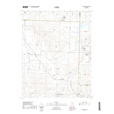
2017 Map of Graniteville
USGS Topo · Published 2017About this map
Graniteville and the surrounding peaks of the Saint Francois Mountains define this section of the Missouri Ozarks. The landscape is marked by its legacy of mineral extraction, evidenced by the large Iron Mountain Tailings Pond and the waters of Iron Mountain Lake. These industrial features sit alongside established communities like Belleview and the lakeside development at Holiday Shores. The terrain is characterized by numerous named peaks including Buford Mtn, Little Iron Mtn, and Cedar Hill, which dictated the winding paths of roads like State Hwy D and Old Hwy 21. Genealogy researchers can locate several burial sites throughout the hills, such as Iron Mountain Cem, Pilot Knob Cem, and Thomas Cem. The map also captures the headwaters and drainage patterns of the Saint Francis River and the E Fork Black River, illustrating how the high granite knobs divide the local watersheds.
Find a feature on this map
101 named features on this map. Tap any name to fly to it.
Don’t see what you’re looking for? This feature index may not catch every label — zoom into the map to look around manually.
Map Details
Editions of this 2017 Graniteville Map
This is the sole edition of this map. No revisions or reprints were ever made.
Other maps of this area

1905 · Bonneterre
USGS Topo · 1:62,500

1906 · Potosi
USGS Topo · 1:62,500

1924 · Edgehill
USGS Topo · 1:62,500

1926 · Edgehill
USGS Topo · 1:62,500

1937 · Ironton
USGS Topo · 1:48,000

1945 · Ironton
USGS Topo · 1:62,500

1946 · Ironton
USGS Topo · 1:62,500

1949 · Rolla
USGS Topo · 1:250,000

1953 · Ironton
USGS Topo · 1:62,500

1953 · Rolla
USGS Topo · 1:250,000