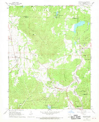
1968 Map of Graniteville
USGS Topo · Published 1970About this map
Elephant Rocks State Park and the surrounding granite-rich terrain of Arcadia and Belleview define this landscape during the late 1960s. The map illustrates a region deeply connected to its geological resources, centered on the historic quarrying village of Graniteville. To the east, the industrial imprint of Iron Mountain is clear, with several mines, quarries, and a substation linked by the Missouri Pacific railroad line.
Find a feature on this map
56 named features on this map. Tap any name to fly to it.
Don’t see what you’re looking for? This feature index may not catch every label — zoom into the map to look around manually.
Map Details
Editions of this 1968 Graniteville Map
2 editions found
Other maps of this area

1905 · Bonneterre
USGS Topo · 1:62,500

1906 · Potosi
USGS Topo · 1:62,500

1924 · Edgehill
USGS Topo · 1:62,500

1926 · Edgehill
USGS Topo · 1:62,500

1937 · Ironton
USGS Topo · 1:48,000

1945 · Ironton
USGS Topo · 1:62,500

1946 · Ironton
USGS Topo · 1:62,500

1949 · Rolla
USGS Topo · 1:250,000

1953 · Ironton
USGS Topo · 1:62,500

1953 · Rolla
USGS Topo · 1:250,000