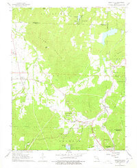
1968 Map of Graniteville
USGS Topo · Published 1978About this map
B U F O R D M O U N T A I N and Middlebrook Hill dominate this landscape in the St. Francois Mountains, where the local economy revolves around the extraction of granite and iron ore. Significant geological landmarks like Elephant Rocks State Park sit adjacent to Graniteville, a settlement defined by numerous Quarries and industrial activity. To the east, the Missouri Pacific railroad serves the community of Middlebrook and the mining operations at Iron Mountain, where a large Quarry and Mines are visible near Iron Mountain Lake.
Find a feature on this map
48 named features on this map. Tap any name to fly to it.
Don’t see what you’re looking for? This feature index may not catch every label — zoom into the map to look around manually.
Map Details
Editions of this 1968 Graniteville Map
2 editions found
Other maps of this area

1905 · Bonneterre
USGS Topo · 1:62,500

1906 · Potosi
USGS Topo · 1:62,500

1924 · Edgehill
USGS Topo · 1:62,500

1926 · Edgehill
USGS Topo · 1:62,500

1937 · Ironton
USGS Topo · 1:48,000

1945 · Ironton
USGS Topo · 1:62,500

1946 · Ironton
USGS Topo · 1:62,500

1949 · Rolla
USGS Topo · 1:250,000

1953 · Ironton
USGS Topo · 1:62,500

1953 · Rolla
USGS Topo · 1:250,000