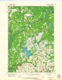
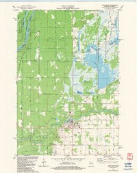
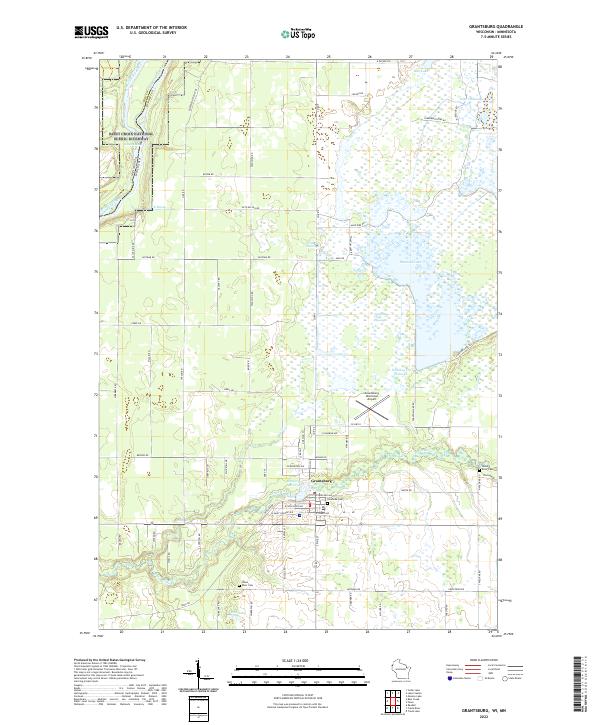
1985 Map of Grantsburg
USGS Topo · Published 1985About this map
The St. Croix River serves as a winding border between Minnesota and Wisconsin in this 1985 survey, defining a landscape of dense forests and extensive wetlands. Large-scale conservation areas such as Governor Knowles State Forest and the Crex Meadows State Wildlife Area dominate the eastern side of the river, while the western side features the established river towns of Pine City and Rush City. The mid-1980s infrastructure is clearly visible, with the Burlington Northern and Soo Line railroads providing critical transport links through the region.
Find a feature on this map
87 named features on this map. Tap any name to fly to it.
Don’t see what you’re looking for? This feature index may not catch every label — zoom into the map to look around manually.
Map Details
Editions of this 1985 Grantsburg Map
2 editions found
Historical Maps of North Branch Through Time
9 maps found