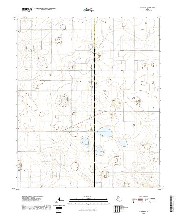
2022 Map of Grassland
USGS Topo · Published 2022About this map
The High Plains landscape of West Texas is defined here by the boundary between Lynn Co and Garza Co, where an extensive grid of agricultural and farm-to-market roads crisscrosses the terrain. This area, known for its flat topography and seasonal playa lakes, is dominated by rural infrastructure including FM 1313 and FM 212. The road network follows a strict cardinal layout, with routes like Co Rd FF, Co Rd HH, and Co Rd II serving as primary connectors through the surrounding fields. While the map lacks named towns, the density of the road system and the presence of numerous numbered county routes, such as Co Rd 250 and Co Rd 105, indicates a highly organized agricultural district. This survey provides a precise look at the modern land divisions and drainage patterns along the county line in the early 21st century.
Find a feature on this map
25 named features on this map. Tap any name to fly to it.
Don’t see what you’re looking for? This feature index may not catch every label — zoom into the map to look around manually.
Map Details
Editions of this 2022 Grassland Map
This is the sole edition of this map. No revisions or reprints were ever made.
Other maps of this area

1954 · Lubbock
USGS Topo · 1:250,000

1965 · Southland
USGS Topo · 1:24,000

1965 · Wilson
USGS Topo · 1:24,000

1968 · South Dokegood Creek
USGS Topo · 1:24,000

1969 · Grassland SE
USGS Topo · 1:24,000

1969 · Post West
USGS Topo · 1:24,000
1969 · Middle Creek
USGS Topo · 1:24,000

1970 · New Lynn
USGS Topo · 1:24,000
1970 · Draw
USGS Topo · 1:24,000

1970 · Grassland
USGS Topo · 1:24,000