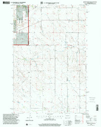
1997 Map of Grassy Butte SE
USGS Topo · Published 2001About this map
The Little Knife River carves a complex path through the badlands of western North Dakota in this late-twentieth-century revision. The landscape reflects the convergence of the state’s energy industry and its cultural heritage, most notably at the Little Knife Gas Plant and a designated Oil Field to the north. These industrial markers stand alongside vestiges of the area's immigrant history, including the Greek Ch and the Russian Cem located near the river's bend.
Find a feature on this map
11 named features on this map. Tap any name to fly to it.
Don’t see what you’re looking for? This feature index may not catch every label — zoom into the map to look around manually.
Map Details
Editions of this 1997 Grassy Butte SE Map
This is the sole edition of this map. No revisions or reprints were ever made.
Other maps of this area

1953 · Watford City
USGS Topo · 1:250,000

1957 · Watford City
USGS Topo · 1:250,000

1963 · Fairfield
USGS Topo · 1:24,000

1963 · Hungry Man Butte
USGS Topo · 1:24,000

1967 · Watford City
USGS Topo · 1:250,000

1973 · Manning NW
USGS Topo · 1:24,000

1974 · Killdeer
USGS Topo · 1:100,000

1974 · Grassy Butte SW
USGS Topo · 1:24,000

1974 · Petes Creek
USGS Topo · 1:24,000

1974 · Fayette
USGS Topo · 1:24,000