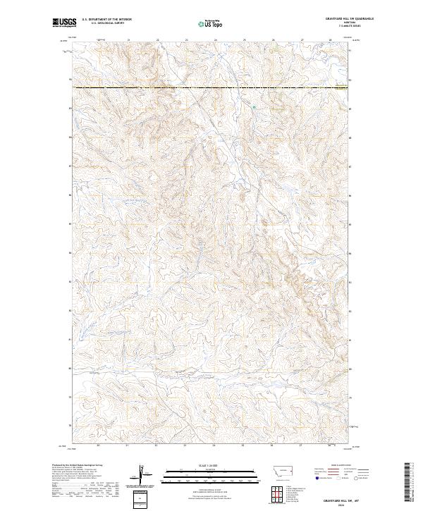
2024 Map of Graveyard Hill SW
USGS Topo · Published 2024About this map
Ash Creek and its various tributaries, including North Fork Ash Creek and Little Fork Ash Creek, define the drainage patterns of this Prairie County landscape. The terrain is divided by the boundary between Dawson County and Prairie County, showing the administrative layout of this portion of eastern Montana. The map highlights a network of service roads such as Oilfield Rd and Pine Unit Rd, which suggest the region's industrial activity and land use. Water features are the primary landmarks in this sparsely populated area, with South Fork Huey Creek and Cedar Creek carving through the hills. This 2024 survey provides a clear look at the modern rural infrastructure and natural hydrology that characterizes the western Great Plains.
Find a feature on this map
14 named features on this map. Tap any name to fly to it.
Don’t see what you’re looking for? This feature index may not catch every label — zoom into the map to look around manually.
Map Details
Editions of this 2024 Graveyard Hill SW Map
This is the sole edition of this map. No revisions or reprints were ever made.
Other maps of this area

1953 · Miles City
USGS Topo · 1:250,000

1957 · Miles City
USGS Topo · 1:250,000

1958 · Miles City
USGS Topo · 1:250,000

1967 · Hoyt
USGS Topo · 1:24,000
1967 · Upper Magpie Reservoir
USGS Topo · 1:24,000

1967 · Twin Forks Reservoir
USGS Topo · 1:24,000

1981 · Mildred NE
USGS Topo · 1:24,000

1981 · Dorothy Draw
USGS Topo · 1:24,000

1981 · Ayer Spring NE
USGS Topo · 1:24,000

1981 · Wibaux
USGS Topo · 1:100,000