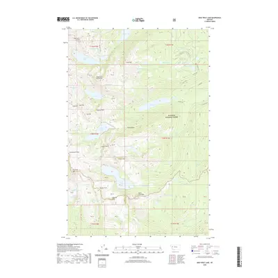
2020 Map of Gray Wolf Lake
USGS Topo · Published 2020About this map
Flathead National Forest defines the high-altitude wilderness of the Mission Range in this modern survey. The terrain is characterized by a dense concentration of glacial basins, including Gray Wolf Lake, Jewell Lake, and the aptly named The Angels Bathing Pool. Peaks such as Daughter of the Sun Mtn and Gray Wolf Peak anchor the ridgelines, while the Swan River and Glacier Cr drain the eastern slopes. The map traces the boundary between Lake and Missoula Counties, illustrating a landscape largely untouched by development except for the winding course of Lindbergh road. This record is particularly valuable for documenting the specific naming of remote alpine features like Sleeping Elk Lake and Weather Peak within a protected ecological corridor.
Find a feature on this map
62 named features on this map. Tap any name to fly to it.
Don’t see what you’re looking for? This feature index may not catch every label — zoom into the map to look around manually.
Map Details
Editions of this 2020 Gray Wolf Lake Map
This is the sole edition of this map. No revisions or reprints were ever made.
Other maps of this area

1921 · Elbow Lake
USGS Topo · 1:125,000

1955 · Choteau
USGS Topo · 1:250,000

1957 · Choteau
USGS Topo · 1:250,000

1958 · Choteau
USGS Topo · 1:250,000

1962 · Choteau
USGS Topo · 1:250,000

1965 · Upper Jocko Lake
USGS Topo · 1:24,000
1965 · Belmore Sloughs
USGS Topo · 1:24,000

1965 · Gray Wolf Lake
USGS Topo · 1:24,000

1965 · Lake Marshall
USGS Topo · 1:24,000
1965 · St Marys Lake
USGS Topo · 1:24,000