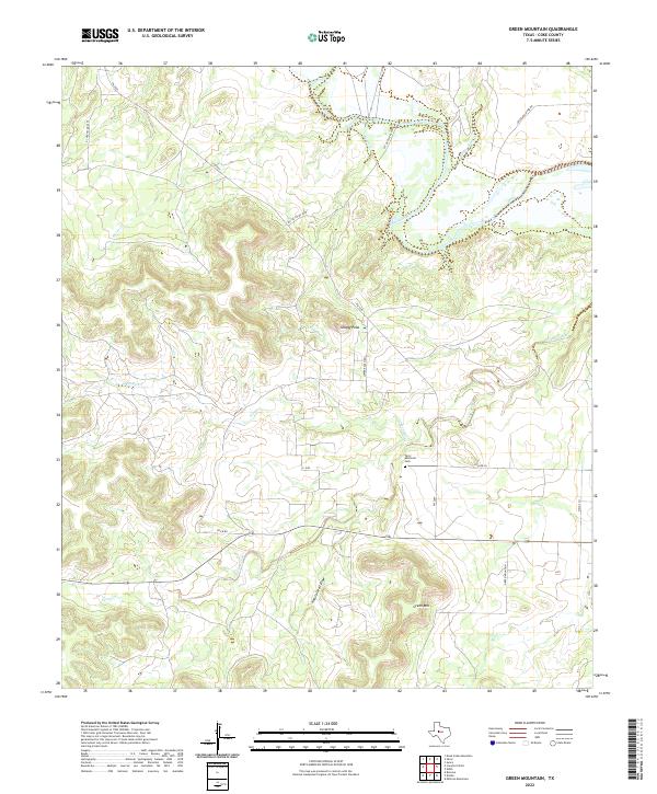
2022 Map of Green Mountain
USGS Topo · Published 2022About this map
The Colorado River defines the northern reaches of this West Texas landscape, where intermittent drainage systems like Bitter Cr and Willmo-Sand Cr carve through the plateau. Central to the area’s relief are prominent landmarks including Shaggy Peak and the namesake Green Mtn, which overlook a network of ranch roads such as Lower Ranch Rd and Price Rd. The presence of the Terry Memorial Cem near the intersection of FM 2059 and Collier Ln provides a focal point for genealogical interest in this sparsely populated portion of Coke County. Water distribution is seasonal and dictated by the terrain, with Pecan Creek and its branches, N Pecan Cr and Pecan Cr, winding through the southern half of the quadrangle alongside the distinct geological feature of Natural Well Draw.
Find a feature on this map
20 named features on this map. Tap any name to fly to it.
Don’t see what you’re looking for? This feature index may not catch every label — zoom into the map to look around manually.
Map Details
Editions of this 2022 Green Mountain Map
This is the sole edition of this map. No revisions or reprints were ever made.
Other maps of this area

1954 · Big Spring
USGS Topo · 1:250,000

1954 · San Angelo
USGS Topo · 1:250,000

1958 · San Angelo
USGS Topo · 1:250,000

1958 · Big Spring
USGS Topo · 1:250,000

1959 · Silver
USGS Topo · 1:24,000

1959 · Dead Indian Mountain
USGS Topo · 1:24,000

1962 · Edith
USGS Topo · 1:24,000

1962 · Sanco
USGS Topo · 1:24,000
1962 · Millican Mountains
USGS Topo · 1:24,000

1962 · Green Mountain
USGS Topo · 1:24,000