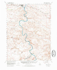
1954 Map of Green River
USGS Topo · Published 1985About this map
Green River and the neighboring settlement of Elgin serve as the primary hubs in this mid-century survey, which focuses on the winding path of the Green River as it carves through the canyonlands of Emery and Grand Counties. The Denver and Rio Grande Western railroad tracks parallel the northern reaches of the river, connecting the area to larger transit networks. South of the town site, the landscape becomes increasingly dominated by intricate drainage systems such as Saleratus Wash and Browns Wash.
Find a feature on this map
32 named features on this map. Tap any name to fly to it.
Don’t see what you’re looking for? This feature index may not catch every label — zoom into the map to look around manually.
Map Details
Editions of this 1954 Green River Map
5 editions found


Other maps of this area

1885 · San Rafael
USGS Topo · 1:250,000

1885 · East Tavaputs
USGS Topo · 1:250,000

1885 · La Sal
USGS Topo · 1:250,000

1886 · Price River
USGS Topo · 1:250,000

1896 · Price River
USGS Topo · 1:250,000

1951 · The Knoll
USGS Topo · 1:62,500

1952 · Tidwell 4 NE
USGS Topo · 1:24,000

1952 · Moab 3 NW
USGS Topo · 1:24,000

1954 · Tidwell 1 NE
USGS Topo · 1:24,000

1954 · Tidwell 1 SW
USGS Topo · 1:24,000