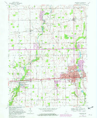
1962 Map of Greenfield
USGS Topo · Published 1982About this map
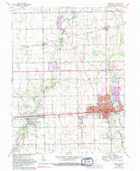
Greenfield serves as the focal point of this Hancock County survey, anchored by the historic Courthouse and a network of schools including Harris Sch and Riley Sch. The landscape is defined by the winding paths of Sugar Creek and Brandywine Creek, which are flanked by several conservation clubs and the Greenfield Country Club. Small rural settlements like Philadelphia, Mohawk, and Maxwell punctuate the agricultural landscape, connected by the Conrail rail line and the prominent National Road. Numerous family and community burial grounds, such as Mt Carmel Cem and Reeves Cem, are scattered throughout the townships of Center and Buck Creek. This edition, featuring 1970s-era purple revisions, documents the expansion of Greenfield's residential footprint into neighboring Bowman Acres and the development of civic infrastructure like the Sewage Disposal plant and Memorial Hospital.
Find a feature on this map
56 named features on this map. Tap any name to fly to it.
Don’t see what you’re looking for? This feature index may not catch every label — zoom into the map to look around manually.
Map Details
Editions of this 1962 Greenfield Map
5 editions found
Other maps of this area

1952 · Cumberland
USGS Topo · 1:24,000

1952 · Greenfield
USGS Topo · 1:24,000

1952 · Fountaintown
USGS Topo · 1:24,000

1952 · Ingalls
USGS Topo · 1:24,000

1952 · Mc Cordsville
USGS Topo · 1:24,000

1953 · Acton
USGS Topo · 1:24,000

1953 · Pendleton
USGS Topo · 1:24,000

1953 · Cincinnati
USGS Topo · 1:250,000

1956 · Cleveland
USGS Topo · 1:24,000

1956 · Morristown
USGS Topo · 1:24,000