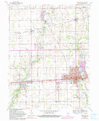
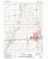
1962 Map of Greenfield
USGS Topo · Published 1990About this map
Greenfield serves as the focal point of this Hancock County landscape, bisected by the historic east-west route of the National Road and the tracks of the Conrail railroad. The settlement pattern shows a classic Indiana grid, where small outlying communities like Mohawk, Philadelphia, and Spring Lake are linked by a dense network of country roads. The region's agricultural character is defined by an extensive drainage system, including Jones Ditch, Henry DITCH, and Brant Ditch, which channel water toward the winding course of Sugar Creek.
Find a feature on this map
55 named features on this map. Tap any name to fly to it.
Don’t see what you’re looking for? This feature index may not catch every label — zoom into the map to look around manually.
Map Details
Editions of this 1962 Greenfield Map
5 editions found
Other maps of this area

1952 · Cumberland
USGS Topo · 1:24,000

1952 · Greenfield
USGS Topo · 1:24,000

1952 · Fountaintown
USGS Topo · 1:24,000

1952 · Ingalls
USGS Topo · 1:24,000

1952 · Mc Cordsville
USGS Topo · 1:24,000

1953 · Acton
USGS Topo · 1:24,000

1953 · Pendleton
USGS Topo · 1:24,000

1953 · Cincinnati
USGS Topo · 1:250,000

1956 · Cleveland
USGS Topo · 1:24,000

1956 · Morristown
USGS Topo · 1:24,000