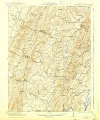
1921 Map of Greenland Gap
USGS Topo · Published 1942About this map
Greenland Gap serves as the namesake cut through the dramatic ridges of the Allegheny Front, a defining geological boundary in Grant County during the early 1920s. This survey, conducted just after the First World War, captures a rural landscape where life centered around dozens of small community structures. The valley between Knobbly Mountain and New Creek Mountain is dotted with institutions like the Mountain Top School and Locust Grove Church, reflecting the scattered settlement patterns of the Potomac Highlands.
Find a feature on this map
88 named features on this map. Tap any name to fly to it.
Don’t see what you’re looking for? This feature index may not catch every label — zoom into the map to look around manually.
Map Details
Editions of this 1921 Greenland Gap Map
3 editions found

Other maps of this area

1891 · Romney
USGS Topo · 1:125,000

1892 · Franklin
USGS Topo · 1:125,000

1892 · Woodstock
USGS Topo · 1:125,000

1895 · Piedmont
USGS Topo · 1:125,000

1896 · Franklin
USGS Topo · 1:125,000

1899 · Oakland
USGS Topo · 1:62,500

1900 · Oakland
USGS Topo · 1:62,500

1916 · Davis
USGS Topo · 1:48,000

1918 · Davis
USGS Topo · 1:62,500

1919 · Elk Garden
USGS Topo · 1:48,000