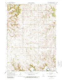
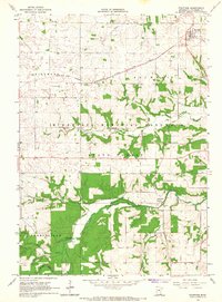
1965 Map of Greenleafton
USGS Topo · Published 1989About this map
The Minnesota Memorial Hardwood State Forest dominates the northern landscape of this Fillmore County borderlands area, where the South Branch Root River carves through the terrain. In the mid-1960s, this region was defined by a scattered network of rural settlements and religious centers. Greenleafton serves as a focal point, supported by nearby sites like the Old Greenleafton Cem and The Church of The Brethren. The economy of the era is evidenced by several Strip Mines and Quarries dotted across the townships of Forestville and Carimona. Near the southern border, the village of Granger sits along the Upper Iowa River, marking the boundary between Minnesota and Iowa. This survey captures a specific pastoral architecture of small cemeteries like Bristol Grove Cem and St Liquori Cem that anchor the local genealogy of the region.
Find a feature on this map
36 named features on this map. Tap any name to fly to it.
Don’t see what you’re looking for? This feature index may not catch every label — zoom into the map to look around manually.
Map Details
Editions of this 1965 Greenleafton Map
2 editions found
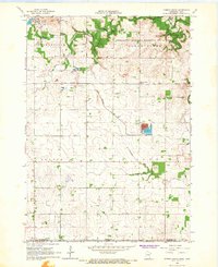
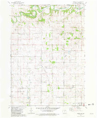
Other maps of this area

1954 · Mason City
USGS Topo · 1:250,000

1957 · Mason City
USGS Topo · 1:250,000

1958 · Mason City
USGS Topo · 1:250,000
1965 · Greenleafton
USGS Topo · 1:24,000
1965 · Harmony
USGS Topo · 1:24,000
1965 · Wykoff
USGS Topo · 1:24,000
1965 · Fountain
USGS Topo · 1:24,000
1965 · Cherry Grove
USGS Topo · 1:24,000
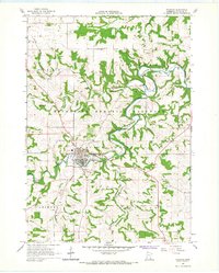
1965 · Preston
USGS Topo · 1:24,000
1981 · Cresco NW
USGS Topo · 1:24,000