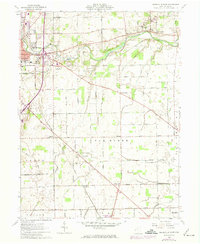
1961 Map of Greenville East
USGS Topo · Published 1974About this map
Greenville Creek carves a path through the heart of Darke County, anchoring a landscape defined by small crossroads settlements and rich agricultural townships. The town of Greenville serves as the regional hub, flanked by the Treaty City Airport and the historical Bears Mill downstream. This 1960s-era topographic view reveals a dense network of country roads like Hogpath Road and Folkerth Road, connecting farming communities such as Abbottsville, Jaysville, and the small cluster at Steel Point. The industrial and transport bones of the county are evident in the intersecting tracks of the Penn Central and Baltimore and Ohio railroads. Genealogists will find significant value in the documentation of local burial grounds, including St Marys Cem, County Home Cem, and the Arcanum-Greenlawn Cem, alongside numerous rural churches like East Zion Ch.
Find a feature on this map
48 named features on this map. Tap any name to fly to it.
Don’t see what you’re looking for? This feature index may not catch every label — zoom into the map to look around manually.
Map Details
Editions of this 1961 Greenville East Map
3 editions found
Other maps of this area

1905 · Brookville
USGS Topo · 1:62,500

1911 · Covington
USGS Topo · 1:62,500

1944 · Covington
USGS Topo · 1:62,500

1953 · Cincinnati
USGS Topo · 1:250,000

1953 · Muncie
USGS Topo · 1:250,000

1956 · Muncie
USGS Topo · 1:250,000

1957 · Cincinnati
USGS Topo · 1:250,000

1960 · New Madison
USGS Topo · 1:24,000

1961 · Laura
USGS Topo · 1:24,000

1961 · Dawn
USGS Topo · 1:24,000