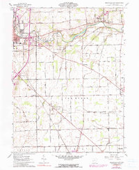
1961 Map of Greenville East
USGS Topo · Published 1990About this map
Greenville serves as the focal point for this survey of eastern Darke County, where the convergence of the Penn Central and Baltimore and Ohio railroads once supported a robust agricultural and industrial economy. The landscape is defined by the winding course of Greenville Creek, which passes by the Darke County Lake Wildlife Area and New Harrison in the northeast. This 1961 record, with 1973 photogrammetric updates, captures the rural character of unincorporated communities like Abbottsville, Nineveh, and Jaysville before modern expansion altered their footprints.
Find a feature on this map
51 named features on this map. Tap any name to fly to it.
Don’t see what you’re looking for? This feature index may not catch every label — zoom into the map to look around manually.
Map Details
Editions of this 1961 Greenville East Map
3 editions found
Other maps of this area

1905 · Brookville
USGS Topo · 1:62,500

1911 · Covington
USGS Topo · 1:62,500

1944 · Covington
USGS Topo · 1:62,500

1953 · Cincinnati
USGS Topo · 1:250,000

1953 · Muncie
USGS Topo · 1:250,000

1956 · Muncie
USGS Topo · 1:250,000

1957 · Cincinnati
USGS Topo · 1:250,000

1960 · New Madison
USGS Topo · 1:24,000

1961 · Laura
USGS Topo · 1:24,000

1961 · Dawn
USGS Topo · 1:24,000