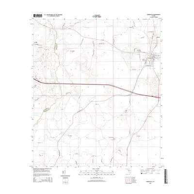
2015 Map of Greenville
USGS Topo · Published 2015About this map
The Aucilla River meanders south along the boundary of Jefferson and Madison Counties, defining a landscape of wetlands and low-lying drainages in North Florida. This area is anchored by the town of Greenville, where the intersection of W Us 90 and SW Us 221 forms a hub for the local community. The mapping detail shows a network of rural routes and family-named landmarks that reflect the deep-rooted agricultural and timber history of the region, including Georgia Pacific Way. Numerous small family and community burial sites are scattered across the terrain, such as New Hopewell Cem to the north and Andrews Cem to the south. Further west, the settlement of Aucilla sits near the river's edge, while smaller locales like Stern and Reams appear along the northern corridors, providing a detailed look at the census divisions and land sections of the early 21st century.
Find a feature on this map
65 named features on this map. Tap any name to fly to it.
Don’t see what you’re looking for? This feature index may not catch every label — zoom into the map to look around manually.
Map Details
Editions of this 2015 Greenville Map
This is the sole edition of this map. No revisions or reprints were ever made.
Other maps of this area

1954 · Greenville
USGS Topo · 1:24,000

1954 · Greenville NE
USGS Topo · 1:24,000

1954 · Valdosta
USGS Topo · 1:250,000

1955 · Lamont
USGS Topo · 1:24,000

1955 · Shady Grove
USGS Topo · 1:24,000

1955 · Lamont SE
USGS Topo · 1:24,000

1955 · Greenville SE
USGS Topo · 1:24,000

1958 · Valdosta
USGS Topo · 1:250,000

1959 · Valdosta
USGS Topo · 1:250,000

1962 · Ashville
USGS Topo · 1:24,000