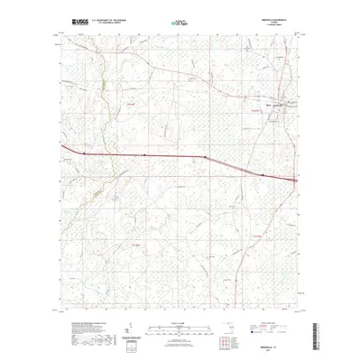
2021 Map of Greenville
USGS Topo · Published 2021About this map
The town of Greenville sits at the eastern edge of this landscape, where the local road network converges near the community of Stern. The geography is defined by a dense network of watercourses and wetlands, with the Little Aucilla River winding through the northern reaches and Rocky Creek and Alligator Creek draining the southern portions of the quadrangle. This 2021 survey illustrates a region where timberlands and rural properties are intersected by a grid of numbered and named routes like Honey Lake Rd and Blue Lake Rd. A significant concentration of rural burial grounds, including New Hopewell Cem, Emery Cem, and Bishop Cem, suggests a long history of family settlements across the Jefferson and Madison county line. The presence of the SW Aucilla Fire Tower Rd points to the importance of forestry management in this part of Florida's Panhandle.
Find a feature on this map
56 named features on this map. Tap any name to fly to it.
Don’t see what you’re looking for? This feature index may not catch every label — zoom into the map to look around manually.
Map Details
Editions of this 2021 Greenville Map
This is the sole edition of this map. No revisions or reprints were ever made.
Other maps of this area

1954 · Greenville
USGS Topo · 1:24,000

1954 · Greenville NE
USGS Topo · 1:24,000

1954 · Valdosta
USGS Topo · 1:250,000

1955 · Lamont
USGS Topo · 1:24,000

1955 · Shady Grove
USGS Topo · 1:24,000

1955 · Lamont SE
USGS Topo · 1:24,000

1955 · Greenville SE
USGS Topo · 1:24,000

1958 · Valdosta
USGS Topo · 1:250,000

1959 · Valdosta
USGS Topo · 1:250,000

1962 · Ashville
USGS Topo · 1:24,000