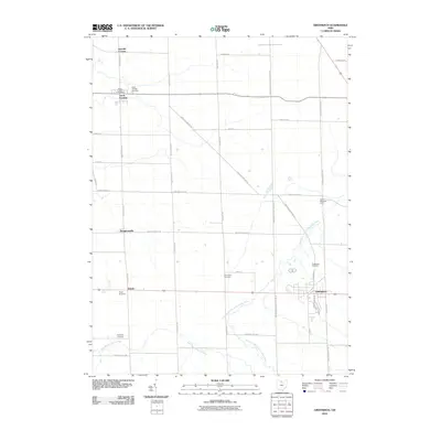
2010 Map of Greenwich
USGS Topo · Published 2010About this map
Greenwich and North Fairfield anchor this survey of southern Huron County, where the agricultural landscape is defined by the headwaters of two regional river systems. The Southwest Branch Vermilion River meanders through the central and eastern sections, while the West Branch Huron River drains the southwest corner. The settlement pattern remains oriented toward historical crossroads, with smaller communities like Boughtonville, Delphi, and Hanville Corners distributed along the primary north-south corridors of New State Rd S and Old State Rd S. Local family and farm history is deeply rooted here, evidenced by several burial grounds including Barre Farm Cemetery and North Fairfield Cemetery. The map also highlights the rural nature of the area through agricultural landmarks like Oney's Milkyway Farm and Barre Farm.
Find a feature on this map
38 named features on this map. Tap any name to fly to it.
Don’t see what you’re looking for? This feature index may not catch every label — zoom into the map to look around manually.
Map Details
Editions of this 2010 Greenwich Map
This is the sole edition of this map. No revisions or reprints were ever made.
Other maps of this area

1908 · Ashland
USGS Topo · 1:62,500

1908 · New London
USGS Topo · 1:62,500

1915 · Norwalk
USGS Topo · 1:62,500

1915 · Crestline
USGS Topo · 1:62,500

1943 · Crestline
USGS Topo · 1:62,500

1944 · Norwalk
USGS Topo · 1:62,500

1950 · Marion
USGS Topo · 1:250,000

1956 · Toledo
USGS Topo · 1:250,000

1960 · New London
USGS Topo · 1:24,000

1960 · Willard
USGS Topo · 1:24,000