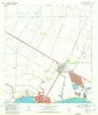
1969 Map of Gregory
USGS Topo · Published 1972About this map
Southern Pacific tracks cut a diagonal through this coastal landscape, connecting the industrial hub of Gregory to the growing residential streets of Portland along the northern shores of Nueces Bay. The 1969 field check reveals a region defined by its energy and maritime infrastructure, featuring an extensive Oil Field and a dedicated Refinery near the deep waters of the La Quinta Turning Basin. Between the busy industrial zones, the map documents civic growth with multiple schools like Austin Sch and Gregory-Portland High Sch. This survey also captures local family landmarks and aviation history at Hunt Airport, alongside significant agricultural and drainage projects like the Taft Drainage Ditch. The proximity of Tailings Ponds and a Sand and Claypit underscores the era's heavy industrial footprint on the San Patricio Co coastline.
Find a feature on this map
45 named features on this map. Tap any name to fly to it.
Don’t see what you’re looking for? This feature index may not catch every label — zoom into the map to look around manually.
Map Details
Editions of this 1969 Gregory Map
4 editions found
Other maps of this area

1925 · Aransas Pass
USGS Topo · 1:62,500

1925 · Corpus Christi
USGS Topo · 1:62,500

1950 · Corpus Christi
USGS Topo · 1:250,000

1951 · Portland
USGS Topo · 1:24,000

1951 · Corpus Christi
USGS Topo · 1:24,000

1951 · Corpus Christi
USGS Topo · 1:62,500

1953 · Beeville
USGS Topo · 1:250,000

1954 · Rockport
USGS Topo · 1:62,500

1954 · Aransas Pass
USGS Topo · 1:24,000

1954 · Port Ingleside
USGS Topo · 1:24,000