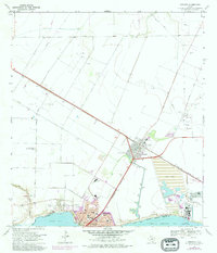
1969 Map of Gregory
USGS Topo · Published 1977About this map
Industrial expansion and residential growth define this coastal landscape on the edge of Nueces Bay during the late 1960s. The town of Gregory sits at a strategic junction where the Southern Pacific railroad lines converge, serving a region heavily marked by the petroleum industry. An extensive Oil Field and numerous scattered Oil Wells dominate the northern plains, while the La Quinta Turning Basin and its associated Tailings Ponds reflect the heavy industrial activity near the shoreline.
Find a feature on this map
39 named features on this map. Tap any name to fly to it.
Don’t see what you’re looking for? This feature index may not catch every label — zoom into the map to look around manually.
Map Details
Editions of this 1969 Gregory Map
4 editions found
Other maps of this area

1925 · Aransas Pass
USGS Topo · 1:62,500

1925 · Corpus Christi
USGS Topo · 1:62,500

1950 · Corpus Christi
USGS Topo · 1:250,000

1951 · Portland
USGS Topo · 1:24,000

1951 · Corpus Christi
USGS Topo · 1:24,000

1951 · Corpus Christi
USGS Topo · 1:62,500

1953 · Beeville
USGS Topo · 1:250,000

1954 · Rockport
USGS Topo · 1:62,500

1954 · Aransas Pass
USGS Topo · 1:24,000

1954 · Port Ingleside
USGS Topo · 1:24,000