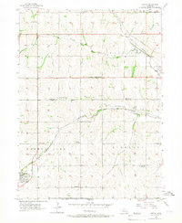
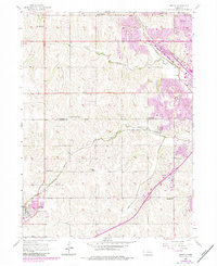
1956 Map of Gretna
USGS Topo · Published 1967About this map
Gretna and Millard anchor this mid-century topographic study of the agricultural landscape southwest of Omaha. The map reveals a dense network of local education and memorial sites, including the Lone Hill Sch, Sunny Slope Sch, and Stender Sch, which served the rural population before school consolidation changed the Midwestern landscape. This era marks a critical point for local genealogy, as it preserves the locations of numerous family and community burial grounds such as Pennsylvania Cem, La Borde Cem, and Mt Auburn Cem.
Find a feature on this map
27 named features on this map. Tap any name to fly to it.
Don’t see what you’re looking for? This feature index may not catch every label — zoom into the map to look around manually.
Map Details
Editions of this 1956 Gretna Map
6 editions found
Other maps of this area

1893 · Fremont
USGS Topo · 1:125,000

1896 · Fremont
USGS Topo · 1:125,000

1955 · Fremont
USGS Topo · 1:250,000

1956 · Gretna
USGS Topo · 1:24,000

1956 · Cedar Creek
USGS Topo · 1:24,000

1956 · Ralston
USGS Topo · 1:24,000

1956 · Springfield
USGS Topo · 1:24,000

1956 · Irvington
USGS Topo · 1:24,000

1957 · Fremont
USGS Topo · 1:250,000

1958 · Fremont
USGS Topo · 1:250,000