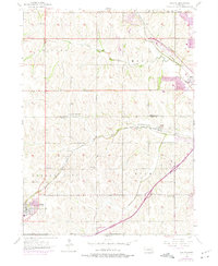
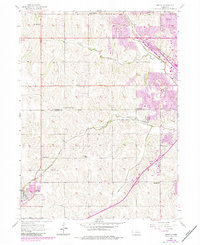
1956 Map of Gretna
USGS Topo · Published 1975About this map
The agricultural landscape of Douglas and Sarpy counties is meticulously documented in this mid-century survey, shortly before the rapid expansion of the Omaha metropolitan area. The town of Gretna serves as a primary hub in the southwest, while Millard and Chalco appear as distinct rail-oriented settlements to the east. The terrain is defined by the drainage of West Papillion Creek and South Papillion Creek, which influenced the placement of the Union Pacific and Chicago Burlington and Quincy railroads. For family historians, the map is a remarkable record of rural social infrastructure, preserving the locations of numerous country schools like School No 14 and Iron Bluff Sch, alongside community burial grounds such as Pennsylvania Cem and the Mt Auburn Cemetery.
Find a feature on this map
25 named features on this map. Tap any name to fly to it.
Don’t see what you’re looking for? This feature index may not catch every label — zoom into the map to look around manually.
Map Details
Editions of this 1956 Gretna Map
6 editions found
Other maps of this area

1893 · Fremont
USGS Topo · 1:125,000

1896 · Fremont
USGS Topo · 1:125,000

1955 · Fremont
USGS Topo · 1:250,000

1956 · Gretna
USGS Topo · 1:24,000

1956 · Cedar Creek
USGS Topo · 1:24,000

1956 · Ralston
USGS Topo · 1:24,000

1956 · Springfield
USGS Topo · 1:24,000

1956 · Irvington
USGS Topo · 1:24,000

1957 · Fremont
USGS Topo · 1:250,000

1958 · Fremont
USGS Topo · 1:250,000