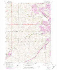
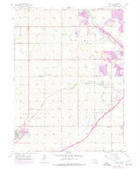
1956 Map of Gretna
USGS Topo · Published 1984About this map
Gretna and the surrounding rural landscapes of eastern Nebraska are captured in this mid-century survey, just as the urban footprint of Omaha began to press westward. The map traces the division between Douglas Co and Sarpy Co, where a network of one-room schoolhouses like Iron Bluff Sch, Lone Hill Sch, and LaBelle Sch served dispersed farming families. The presence of these small district schools alongside family-named landmarks like Stender Sch and Sunny Slope Sch offers a detailed view of the region's educational and social organization before modern consolidation.
Find a feature on this map
22 named features on this map. Tap any name to fly to it.
Don’t see what you’re looking for? This feature index may not catch every label — zoom into the map to look around manually.
Map Details
Editions of this 1956 Gretna Map
6 editions found
Other maps of this area

1893 · Fremont
USGS Topo · 1:125,000

1896 · Fremont
USGS Topo · 1:125,000

1955 · Fremont
USGS Topo · 1:250,000

1956 · Gretna
USGS Topo · 1:24,000

1956 · Cedar Creek
USGS Topo · 1:24,000

1956 · Ralston
USGS Topo · 1:24,000

1956 · Springfield
USGS Topo · 1:24,000

1956 · Irvington
USGS Topo · 1:24,000

1957 · Fremont
USGS Topo · 1:250,000

1958 · Fremont
USGS Topo · 1:250,000