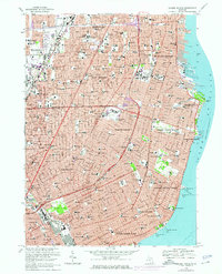
1968 Map of Grosse Pointe
USGS Topo · Published 1974About this map
The suburban landscape of Wayne and Macomb counties is captured here during a period of intense post-war expansion. Dense residential grids extend from the northern edge of Detroit through a series of affluent shoreline communities, including Grosse Pointe, Grosse Pointe Farms, and St Clair Shores. This period represents the height of the automotive era's influence on urban planning, with the Edsel Ford Freeway cutting through established neighborhoods and facilitating the growth of major retail hubs like the Eastland Shopping Center. Along the western edge, the Detroit City Airport serves as a critical transport anchor.
Find a feature on this map
136 named features on this map. Tap any name to fly to it.
Don’t see what you’re looking for? This feature index may not catch every label — zoom into the map to look around manually.
Map Details
Editions of this 1968 Grosse Pointe Map
4 editions found
Other maps of this area

1905 · Detroit
USGS Topo · 1:62,500

1905 · Grosse Pointe
USGS Topo · 1:62,500

1908 · Rochester
USGS Topo · 1:62,500

1912 · Mt Clemens
USGS Topo · 1:62,500

1918 · Detroit
USGS Topo · 1:62,500

1918 · Grosse Pointe
USGS Topo · 1:62,500

1924 · Detroit
USGS Topo · 1:62,500

1929 · Mt Clemens
USGS Topo · 1:62,500

1934 · Detroit
USGS Topo · 1:62,500

1936 · Warren
USGS Topo · 1:31,680