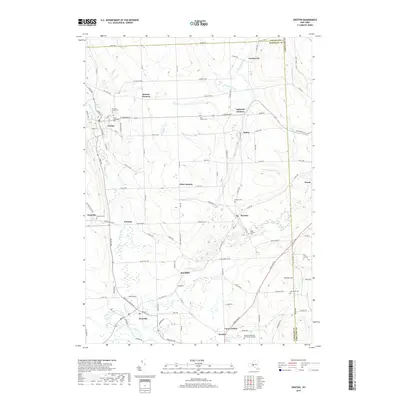
2019 Map of Groton
USGS Topo · Published 2019About this map
Groton and Dryden anchor this central New York landscape where the headwaters of the Owasco Inlet and Fall Creek carve through the glacial terrain. The area is defined by a network of historic crossroads and small settlements, including Groton City, Lafayette Corners, McLean, and Freeville. Genealogists will find a significant concentration of burial grounds, such as Groton Rural Cem, Saint Patricks Cem, and the Gee Town Cem near Simms Hill. The southern portion of the map highlights the modern influence of the Tompkins Cortland Community College campus situated near Lacy Corners. Between these hubs, the map shows a landscape transitioning from the industry of Red Mills to the quiet reaches of Beaver Cr and Mud Pond.
Find a feature on this map
115 named features on this map. Tap any name to fly to it.
Don’t see what you’re looking for? This feature index may not catch every label — zoom into the map to look around manually.
Map Details
Editions of this 2019 Groton Map
This is the sole edition of this map. No revisions or reprints were ever made.
Other maps of this area

1898 · Moravia
USGS Topo · 1:62,500

1900 · Dryden
USGS Topo · 1:62,500

1902 · Moravia
USGS Topo · 1:62,500

1903 · Cortland
USGS Topo · 1:62,500

1903 · Harford
USGS Topo · 1:62,500

1906 · Catatonk
USGS Topo · 1:125,000

1942 · Groton
USGS Topo · 1:24,000

1943 · Moravia
USGS Topo · 1:31,680

1943 · West Groton
USGS Topo · 1:31,680

1943 · Groton
USGS Topo · 1:31,680