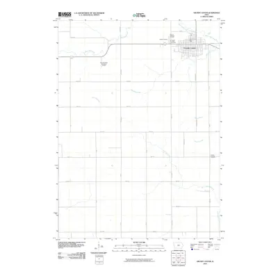
2010 Map of Grundy Center
USGS Topo · Published 2010About this map
Grundy Center anchors this Iowa landscape, showing its organized street grid and civic essentials including the Grundy Center Post Office. The surrounding terrain is a quintessential agricultural grid of Grundy County, defined by a dense network of sectional roads such as W Home and Fairgrounds. Water drainage across these fields is managed by several named tributaries, most notably Black Hawk Creek to the north and the winding paths of Minnehaha Creek and Little Wolf Creek to the south.
Find a feature on this map
36 named features on this map. Tap any name to fly to it.
Don’t see what you’re looking for? This feature index may not catch every label — zoom into the map to look around manually.
Map Details
Editions of this 2010 Grundy Center Map
This is the sole edition of this map. No revisions or reprints were ever made.
Other maps of this area

1954 · Waterloo
USGS Topo · 1:250,000

1955 · Waterloo
USGS Topo · 1:250,000

1960 · Marshalltown
USGS Topo · 1:62,500

1960 · Conrad West
USGS Topo · 1:24,000

1960 · Conrad East
USGS Topo · 1:24,000

1971 · Dike
USGS Topo · 1:24,000

1971 · Lincoln
USGS Topo · 1:24,000
1971 · Gladbrook
USGS Topo · 1:24,000

1979 · Grundy Center
USGS Topo · 1:24,000

1979 · Holland
USGS Topo · 1:24,000