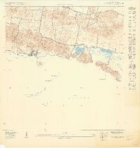
1949 Map of Guanica
USGS Topo · Published 1949About this map
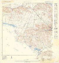
Salt production and coastal agriculture dominate this southwest Puerto Rican landscape, where the boundary between Lajas and Guánica divides the rolling terrain. The coastline is defined by numerous lagoons and salt works, including Salinas Fortuna and the complex around Salinas Providencia, indicating the vital importance of the salt industry to the local economy during the late 1940s. Inland, the topography rises toward Cerro Lajara and Cerro Montalva, while the northern portion of the sheet shows the southern edge of the Laguna de Guánica and its adjacent Ciénaga. Small rural communities and educational outposts like Escuela Ceiba and Escuela Las Colinas are scattered throughout the hills and flats, connected by emerging infrastructure such as Route 116. The presence of Escuela José Gautier Benítez near the shore at Ensenada highlights the concentrated settlement patterns of this period.
Find a feature on this map
30 named features on this map. Tap any name to fly to it.
Don’t see what you’re looking for? This feature index may not catch every label — zoom into the map to look around manually.
Map Details
Editions of this 1949 Guanica Map
This is the sole edition of this map. No revisions or reprints were ever made.
Other maps of this area

1937 · San German
USGS Topo · 1:25,000

1937 · Sabana Grande
USGS Topo · 1:25,000
1938 · Guanica
USGS Topo · 1:30,000

1938 · Parguera
USGS Topo · 1:30,000

1941 · San German
USGS Topo · 1:30,000

1941 · Sabana Grande
USGS Topo · 1:30,000
1949 · Guanica NE
USGS Topo · 1:10,000
1949 · San German SE
USGS Topo · 1:10,000
1949 · Parguera NE
USGS Topo · 1:10,000
1949 · Sabana Grande SO
USGS Topo · 1:10,000