1949 Map of Parguera NE
USGS Topo · Published 1949About this map
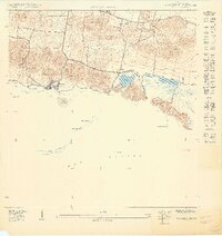
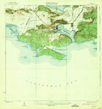
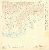
Parguera and the nearby settlement of Papayo anchor this 1940s topography of the Lajas coastline, where the land meets the Mar Caribe. The map reveals a shoreline characterized by intricate inlets and salt flats, including Salinas and Fortuna, positioned beneath the elevations of Cerro Parguera and Cerro Covanas. Inland, the Escuela Ramón Baldorioty de Castro serves as a primary landmark for the local community. The coastal waters are dotted with a series of cays and islands, such as Isla Maguey, Cayo Bayo, and the elongated Cayo Enrique, which protect the inner waters of Bahía Montalva. This survey, conducted using plane table methods in 1935 and 1949, documents a period before significant modern coastal development, showing the original footprints of these fishing and agricultural hamlets and their relationship to the surrounding limestone hills.
Find a feature on this map
19 named features on this map. Tap any name to fly to it.
Don’t see what you’re looking for? This feature index may not catch every label — zoom into the map to look around manually.
Map Details
Editions of this 1949 Parguera NE Map
This is the sole edition of this map. No revisions or reprints were ever made.
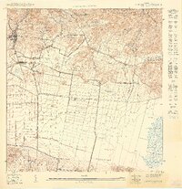
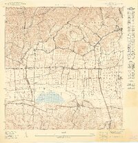
Other maps of this area

1937 · San German
USGS Topo · 1:25,000

1937 · Sabana Grande
USGS Topo · 1:25,000
1938 · Guanica
USGS Topo · 1:30,000

1938 · Parguera
USGS Topo · 1:30,000

1941 · San German
USGS Topo · 1:30,000

1941 · Sabana Grande
USGS Topo · 1:30,000
1949 · San German SE
USGS Topo · 1:10,000
1949 · San German SO
USGS Topo · 1:10,000
1949 · Parguera NO
USGS Topo · 1:10,000
1949 · Guanica
USGS Topo · 1:10,000