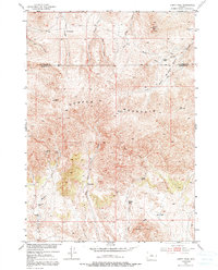
1952 Map of Guffy Peak
USGS Topo · Published 1991About this map
Copper Mountain and the high ridges of the Bridger Basin dominate this central Wyoming landscape as it appeared in the early 1950s. The map captures a moment when tungsten and copper exploration was active along the southern slopes, evidenced by the Stardust Tungsten Mine and Comet Tungsten Mine. These small-scale operations, along with the Mc Graw Copper Mine, reflect the mid-century mineral interest in the region.
Find a feature on this map
30 named features on this map. Tap any name to fly to it.
Don’t see what you’re looking for? This feature index may not catch every label — zoom into the map to look around manually.
Map Details
Editions of this 1952 Guffy Peak Map
4 editions found
Other maps of this area

1951 · Birdseye Pass
USGS Topo · 1:24,000

1951 · Bonneville
USGS Topo · 1:24,000

1952 · Gates Butte
USGS Topo · 1:24,000

1952 · Rathbun Ranch
USGS Topo · 1:24,000

1952 · Picard Ranch
USGS Topo · 1:24,000

1952 · De Pass
USGS Topo · 1:24,000

1952 · Guffy Peak
USGS Topo · 1:24,000

1955 · Thermopolis
USGS Topo · 1:250,000

1955 · Arminto
USGS Topo · 1:250,000

1957 · Rathbun Ranch
USGS Topo · 1:24,000