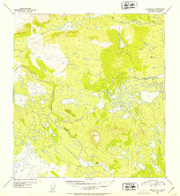
1952 Map of Gulkana C-6
USGS Topo · Published 1953About this map
Tyone Village stands as a primary settlement node along the northern shore of Tyone Lake in this 1950s-era topographic study. The landscape is defined by an intricate network of wetlands, small ponds, and major drainage systems, including the southward-flowing Tyone River and the West Fork Gulkana River in the northeast. Surveyors established critical triangulation points at high elevations, marked by VABM 3537 Tyone and VABM 2680 Wonderly, providing the vertical control necessary to map this complex hydrological environment. The distribution of features suggests a reliance on the river and lake systems for movement across the interior, with the village positioned at a strategic junction between the open water and the surrounding tundra and hills.
Find a feature on this map
6 named features on this map. Tap any name to fly to it.
Don’t see what you’re looking for? This feature index may not catch every label — zoom into the map to look around manually.
Map Details
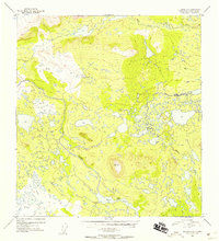
Editions of this 1952 Gulkana C-6 Map
3 editions found
Other maps of this area

1950 · Talkeetna Mountains
USGS Topo · 1:250,000

1950 · Gulkana B-6
USGS Topo · 1:63,360

1951 · Gulkana
USGS Topo · 1:250,000

1951 · Gulkana D-6
USGS Topo · 1:63,360

1951 · Talkeetna Mountains B-1
USGS Topo · 1:63,360

1951 · Gulkana B-5
USGS Topo · 1:63,360

1951 · Gulkana D-5
USGS Topo · 1:63,360

1951 · Gulkana C-5
USGS Topo · 1:63,360

1951 · Talkeetna Mountains C-1
USGS Topo · 1:63,360

1951 · Talkeetna Mountains D-1
USGS Topo · 1:63,360