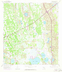
1959 Map of Gum Lake
USGS Topo · Published 1972About this map
The expansive wetlands of the Green Swamp dominate this mid-century survey of Polk County, where the transition from dense hydric landscapes to rising citrus-growing terrain is clearly mapped. The northern portion of the sheet is defined by the Pipeline cutting through the muck, while the southern edge shows the encroaching development of Haines City. Scattered settlements like Holiday Manor and the presence of the Radio Towers (WGTO) indicate the region's mid-century communication and residential expansion.
Find a feature on this map
21 named features on this map. Tap any name to fly to it.
Don’t see what you’re looking for? This feature index may not catch every label — zoom into the map to look around manually.
Map Details
Editions of this 1959 Gum Lake Map
5 editions found
Other maps of this area

1944 · Polk City
USGS Topo · 1:31,680

1944 · Auburndale
USGS Topo · 1:31,680

1953 · Dundee
USGS Topo · 1:24,000

1953 · Intercession City
USGS Topo · 1:24,000

1953 · Davenport
USGS Topo · 1:24,000

1955 · Orlando
USGS Topo · 1:250,000

1957 · Orlando
USGS Topo · 1:250,000

1958 · Orlando
USGS Topo · 1:250,000

1959 · Gum Lake
USGS Topo · 1:24,000

1959 · Lake Louisa SW
USGS Topo · 1:24,000