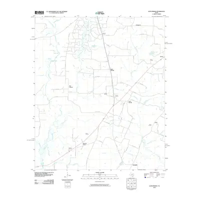
2010 Map of Gum Springs
USGS Topo · Published 2010About this map
Good Springs and Big Springs anchor this portion of Rusk County, where the landscape is defined by the headwaters and branches of Bowles Creek and Johnson Creek. The 2010 survey reveals a community structure heavily influenced by small family settlements and burial grounds, such as Waggoner Cemetery and Boatright Cemetery, often located near significant intersections or watercourses. The presence of Ashby Lake and the northern tip of Lake Striker suggests a region where water management and local reservoirs have shaped the topography alongside a dense network of county roads. These roads connect older locales like Pleasant Grove and Stringtown with newer developments, maintaining a traditional East Texas pattern of dispersed rural communities and small-scale agriculture centered around named branches like Gin Branch and Camp Branch.
Find a feature on this map
70 named features on this map. Tap any name to fly to it.
Don’t see what you’re looking for? This feature index may not catch every label — zoom into the map to look around manually.
Map Details
Editions of this 2010 Gum Springs Map
This is the sole edition of this map. No revisions or reprints were ever made.
Other maps of this area

1935 · Henderson
USGS Topo · 1:48,000

1937 · Troupe
USGS Topo · 1:48,000

1939 · Henderson
USGS Topo · 1:62,500

1943 · Troup
USGS Topo · 1:62,500

1943 · Cushing
USGS Topo · 1:62,500

1943 · Rusk
USGS Topo · 1:62,500

1945 · Cushing
USGS Topo · 1:62,500

1945 · Rusk
USGS Topo · 1:62,500

1953 · Palestine
USGS Topo · 1:250,000

1956 · Tyler
USGS Topo · 1:250,000