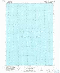
1991 Map of Gunnison Island NE
USGS Topo · Published 1991About this map
Gunnison Bay dominates this topographic study of a significant portion of the Great Salt Lake in Box Elder County. This 1991 publication is based on aerial photography dating back to 1969, with revisions through 1987, showing the water body at a noted Elevation 4200. The map is almost entirely aqueous, providing an unobstructed look at the northern reaches of the lake during a specific hydrological window. For researchers of Utah’s inland sea, it offers a clean record of the shoreline and depth context for this specific quadrant before late-twentieth-century water level fluctuations altered the visible landscape.
Find a feature on this map
3 named features on this map. Tap any name to fly to it.
Don’t see what you’re looking for? This feature index may not catch every label — zoom into the map to look around manually.
Map Details
Editions of this 1991 Gunnison Island NE Map
This is the sole edition of this map. No revisions or reprints were ever made.
Other maps of this area

1954 · Brigham City
USGS Topo · 1:250,000

1958 · Brigham City
USGS Topo · 1:250,000

1962 · Brigham City
USGS Topo · 1:250,000

1968 · Rozel
USGS Topo · 1:24,000

1968 · Coyote Point
USGS Topo · 1:24,000

1968 · Rozel Point
USGS Topo · 1:24,000

1969 · Rozel Point SW
USGS Topo · 1:24,000

1969 · Spring Bay SW
USGS Topo · 1:24,000

1969 · Gunnison Island SW
USGS Topo · 1:24,000

1969 · Gunnison Island
USGS Topo · 1:24,000