
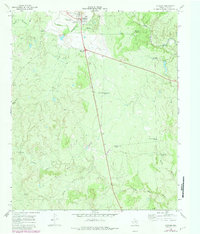
1968 Map of Guthrie
USGS Topo · Published 1971About this map
Guthrie, the county seat of King County, stands as the central settlement in this West Texas landscape, defined by its ranching infrastructure and river systems. The town is marked by its Ch, a Water Tank, and an Athletic Field, serving as a hub for the surrounding livestock operations. The topography is intricately carved by the South Wichita River and North Croton Creek, along with named canyons like Harper Young Canyon.
Find a feature on this map
23 named features on this map. Tap any name to fly to it.
Don’t see what you’re looking for? This feature index may not catch every label — zoom into the map to look around manually.
Map Details
Editions of this 1968 Guthrie Map
2 editions found
Other maps of this area

1954 · Lubbock
USGS Topo · 1:250,000

1958 · Southerland Canyon
USGS Topo · 1:24,000

1959 · Bob Creek
USGS Topo · 1:24,000

1966 · J Y Ranch
USGS Topo · 1:24,000

1967 · Guthrie NW
USGS Topo · 1:24,000

1967 · Dark Canyon
USGS Topo · 1:24,000

1967 · Fourmile Hill
USGS Topo · 1:24,000

1967 · Kiowa Peak NW
USGS Topo · 1:24,000

1968 · Pitchfork Flats
USGS Topo · 1:24,000

1985 · Dickens
USGS Topo · 1:100,000