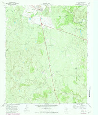
1968 Map of Guthrie
USGS Topo · Published 1981About this map
Guthrie serves as the focal point of this King County landscape, shown here at the intersection of State Routes 82 and 83. The settlement's layout includes a Water Tank, an Athletic Field, and a Ch, surrounded by a vast network of water-management features critical to West Texas ranching. The terrain is defined by the winding paths of the South Wichita River to the north and North Croton Creek to the south, with the land between marked by numerous named water sources such as Salt Knob Windmill and the Old Wooden Town Windmill. The presence of a Landing Strip and a Pipeline cutting through the brush country reflects the mid-century infrastructure of the region. Local industrial activity is evidenced by a Gravel Pit near the river and an isolated Oil Well in the southeast, illustrating the sparse but deliberate development of this expansive prairie environment.
Find a feature on this map
35 named features on this map. Tap any name to fly to it.
Don’t see what you’re looking for? This feature index may not catch every label — zoom into the map to look around manually.
Map Details
Editions of this 1968 Guthrie Map
2 editions found
Other maps of this area

1954 · Lubbock
USGS Topo · 1:250,000

1958 · Southerland Canyon
USGS Topo · 1:24,000

1959 · Bob Creek
USGS Topo · 1:24,000

1966 · J Y Ranch
USGS Topo · 1:24,000

1967 · Guthrie NW
USGS Topo · 1:24,000

1967 · Dark Canyon
USGS Topo · 1:24,000

1967 · Fourmile Hill
USGS Topo · 1:24,000

1967 · Kiowa Peak NW
USGS Topo · 1:24,000

1968 · Guthrie
USGS Topo · 1:24,000

1968 · Pitchfork Flats
USGS Topo · 1:24,000