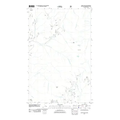
2011 Map of Gypsy Peak
USGS Topo · Published 2011About this map
Gypsy Peak and the surrounding high ridges of the Selkirk Mountains define this remote landscape along the Washington-British Columbia border. The terrain is deeply carved by water systems including Styx Creek, Slate Creek, and Leola Creek, which drain toward the northeast. Human impact on the land is concentrated in specific industrial and monitoring sites, most notably the Lead Hill Mine located near Lead Hill. The presence of the State Creek Lookout and high alpine features like the Gypsy Lakes and Watch Lake suggests a region primarily used for resource extraction, fire observation, and backcountry recreation. Trails and forest roads, including routes 102 and 3155, provide the only access through the steep elevation changes between Sullivan Mountain and the international boundary at Boundary Mountain.
Find a feature on this map
28 named features on this map. Tap any name to fly to it.
Don’t see what you’re looking for? This feature index may not catch every label — zoom into the map to look around manually.
Map Details
Editions of this 2011 Gypsy Peak Map
This is the sole edition of this map. No revisions or reprints were ever made.
Other maps of this area

1934 · Metaline
USGS Topo · 1:125,000

1942 · Metaline
USGS Topo · 1:125,000

1958 · Sandpoint
USGS Topo · 1:250,000

1963 · Sandpoint
USGS Topo · 1:250,000

1967 · Gypsy Peak
USGS Topo · 1:24,000

1967 · Boundary Dam
USGS Topo · 1:24,000

1967 · Salmo Mtn.
USGS Topo · 1:24,000

1967 · Metaline Falls
USGS Topo · 1:24,000

1967 · Helmer Mtn
USGS Topo · 1:24,000

1967 · Pass Creek
USGS Topo · 1:24,000