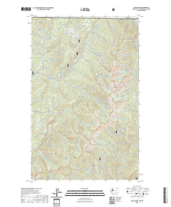
2023 Map of Gypsy Peak
USGS Topo · Published 2023About this map
Gypsy Peak stands as the central high point of this northern Washington landscape, situated along the international boundary with Canada. This 2023 survey documents the high-altitude terrain within the Colville National Forest and the Salmo-Priest Wilderness, where a dense network of mountain streams like Slate Creek and Gypsy Creek drain the surrounding ridges. The map emphasizes long-distance trail connectivity, featuring segments of the Pacific Northwest National Scenic Trl alongside the Crowell Ridge Trl and Slate Creek Trl. These routes navigate a landscape defined by significant landmarks such as Bear Pasture, Lead Hill, and Boundary Mtn. The hydrology of the region is notably captured through the inclusion of remote alpine water bodies including the Gypsy Lakes and Watch Lake, providing essential detail for those studying the drainage patterns of Pend Oreille County.
Find a feature on this map
38 named features on this map. Tap any name to fly to it.
Don’t see what you’re looking for? This feature index may not catch every label — zoom into the map to look around manually.
Map Details
Editions of this 2023 Gypsy Peak Map
This is the sole edition of this map. No revisions or reprints were ever made.
Other maps of this area

1934 · Metaline
USGS Topo · 1:125,000

1942 · Metaline
USGS Topo · 1:125,000

1958 · Sandpoint
USGS Topo · 1:250,000

1963 · Sandpoint
USGS Topo · 1:250,000

1967 · Gypsy Peak
USGS Topo · 1:24,000

1967 · Boundary Dam
USGS Topo · 1:24,000

1967 · Salmo Mtn.
USGS Topo · 1:24,000

1967 · Metaline Falls
USGS Topo · 1:24,000

1967 · Helmer Mtn
USGS Topo · 1:24,000

1967 · Pass Creek
USGS Topo · 1:24,000