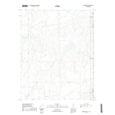
2019 Map of Hackberry Creek
USGS Topo · Published 2019About this map
The Washita River winds through the northern portion of this landscape along the border of Oklahoma and Texas, where the terrain of Roger Mills County is defined by deep draws and creek beds. This modern topographic study reveals a rural expanse dominated by water management and a network of secondary roads such as Six Mile and Fm 277. Significant infrastructure includes the Soil Conservation Service Site 28 Reservoir and Soil Conservation Service Site 45 Reservoir, which demonstrate mid-century and later efforts to control erosion and manage water resources in the High Plains. The drainage pattern is led by the southern reach of Hackberry Cr and the seasonal path of Mulberry Draw, illustrating the hydrological challenges of this semi-arid region.
Find a feature on this map
18 named features on this map. Tap any name to fly to it.
Don’t see what you’re looking for? This feature index may not catch every label — zoom into the map to look around manually.
Map Details
Editions of this 2019 Hackberry Creek Map
This is the sole edition of this map. No revisions or reprints were ever made.
Other maps of this area

1954 · Amarillo
USGS Topo · 1:250,000

1955 · Clinton
USGS Topo · 1:250,000

1957 · Clinton
USGS Topo · 1:250,000

1958 · Amarillo
USGS Topo · 1:250,000

1961 · Reydon
USGS Topo · 1:62,500

1963 · Allison
USGS Topo · 1:24,000

1963 · Allison SW
USGS Topo · 1:24,000

1966 · Durham
USGS Topo · 1:24,000

1967 · Gem
USGS Topo · 1:24,000

1967 · Hackberry Creek
USGS Topo · 1:24,000