
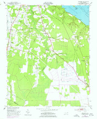
1951 Map of Hackney
USGS Topo · Published 1953About this map
The coastal lowlands of Beaufort County are defined here by a dense network of swamp runs and drainage canals near the Pamlico River. Land use in the early 1950s is distinctly divided between the agricultural clearings surrounding the Hackney and Rover settlements and the expansive, undeveloped reaches of the Reedy Pocosin and Blount Pocosin. The influence of water on the local economy is evident in the complex system of agricultural engineering, including the Gum Run Canal, Lot Canal, and Dividing Canal, which suggest a concerted effort to manage the saturated terrain for farming.
Find a feature on this map
47 named features on this map. Tap any name to fly to it.
Don’t see what you’re looking for? This feature index may not catch every label — zoom into the map to look around manually.
Map Details
Editions of this 1951 Hackney Map
3 editions found
Other maps of this area

1902 · Vanceboro
USGS Topo · 1:62,500

1903 · Chocowinity
USGS Topo · 1:62,500

1904 · Vanceboro
USGS Topo · 1:62,500

1905 · Chocowinity
USGS Topo · 1:62,500

1905 · Vanceboro
USGS Topo · 1:62,500

1943 · Plymouth
USGS Topo · 1:125,000

1950 · Edward
USGS Topo · 1:24,000

1951 · Bunyan
USGS Topo · 1:24,000

1951 · Washington
USGS Topo · 1:24,000

1953 · Blounts Bay
USGS Topo · 1:24,000