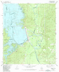
1985 Map of Haddens
USGS Topo · Published 1985About this map
The Sabine River serves as the focal point of this 1985 survey, defining the border between Louisiana and Texas where the Toledo Bend Reservoir meets a complex system of sloughs and bayous. The landscape is heavily influenced by water management and conservation, featuring the Normal Pool Elevation 172 and a nearby Power Plant and Spillway. Settlement patterns are sparse and rural, with small communities like Haddens and Hunter situated east of the reservoir near the Sabine Parish and Vernon Parish line.
Find a feature on this map
48 named features on this map. Tap any name to fly to it.
Don’t see what you’re looking for? This feature index may not catch every label — zoom into the map to look around manually.
Map Details
Editions of this 1985 Haddens Map
2 editions found
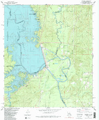
Other maps of this area

1941 · Leesville
USGS Topo · 1:62,500

1942 · Florien
USGS Topo · 1:62,500

1943 · Leesville
USGS Topo · 1:62,500

1944 · Negreet
USGS Topo · 1:62,500

1944 · Wiergate
USGS Topo · 1:62,500

1944 · Florien
USGS Topo · 1:62,500

1946 · Leesville
USGS Topo · 1:62,500

1948 · Leesville
USGS Topo · 1:62,500

1948 · Wiergate
USGS Topo · 1:62,500

1953 · Alexandria
USGS Topo · 1:250,000