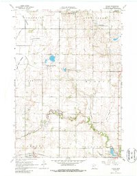
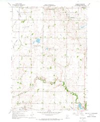
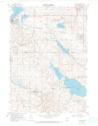
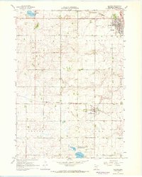
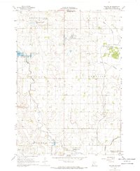
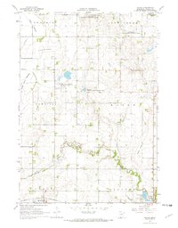
1967 Map of Hadley
USGS Topo · Published 1988About this map
The Chicago and North Western railroad corridor anchors the southern edge of this Murray County landscape, connecting the village of Hadley to the surrounding agricultural prairie. This 1967 field-checked survey reveals a region defined by its hydrology and conservation efforts, specifically the numerous dry lake basins such as the Great Oasis Lakebed, Crooked Lakebed, and Rush Lakebed. These former water bodies, along with the meandering Beaver Creek, illustrate the post-glacial topography of southwestern Minnesota.
Find a feature on this map
26 named features on this map. Tap any name to fly to it.
Don’t see what you’re looking for? This feature index may not catch every label — zoom into the map to look around manually.
Map Details
Editions of this 1967 Hadley Map
3 editions found
Other maps of this area

1953 · New Ulm
USGS Topo · 1:250,000

1954 · Fairmont
USGS Topo · 1:250,000

1957 · New Ulm
USGS Topo · 1:250,000

1958 · New Ulm
USGS Topo · 1:250,000

1958 · Fairmont
USGS Topo · 1:250,000

1967 · New Ulm
USGS Topo · 1:250,000
1967 · Balaton
USGS Topo · 1:24,000
1967 · Slayton
USGS Topo · 1:24,000
1967 · Balaton SW
USGS Topo · 1:24,000
1967 · Hadley
USGS Topo · 1:24,000