2018 Map of Hagemeister Island C-3 NW
USGS Topo · Published 2018About this map
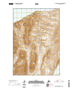
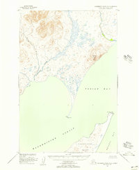
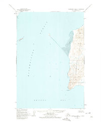
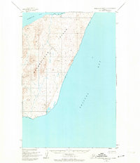
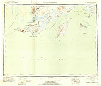
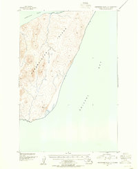
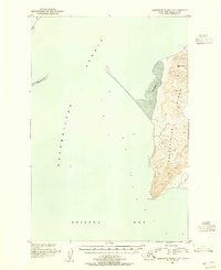
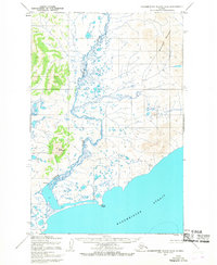
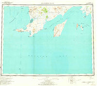
Hagemeister Island dominates this 2018 topographic survey, revealing a landscape defined by intense coastal contouring and complex interior wetlands. The northern edge of the island is separated from the Alaskan mainland by Hagemeister Strait, while its southern reaches front the open Pacific Ocean. The map provides a detailed view of the island's interior drainage patterns, where numerous small streams and ponds are interspersed among rising elevations. As part of the Dillingham Census Area, this terrain remains largely undeveloped, showcasing the raw coastal geography of the Bristol Bay region. The absence of infrastructure or named settlements on this sheet emphasizes the island's role as a protected wilderness area, with the mapping focusing strictly on the natural landforms and the maritime boundaries of the Pacific Ocean.
Find a feature on this map
9 named features on this map. Tap any name to fly to it.
Don’t see what you’re looking for? This feature index may not catch every label — zoom into the map to look around manually.
Map Details
Editions of this 2018 Hagemeister Island C-3 NW Map
This is the sole edition of this map. No revisions or reprints were ever made.
Other maps of this area
1948 · Hagemeister Island D-3
USGS Topo · 1:63,360
1948 · Hagemeister Island C-4
USGS Topo · 1:63,360
1948 · Hagemeister Island C-3
USGS Topo · 1:63,360
1951 · Hagemeister Island
USGS Topo · 1:250,000
1952 · Hagemeister Island C-3
USGS Topo · 1:63,360
1952 · Hagemeister Island C-4
USGS Topo · 1:63,360
1954 · Hagemeister Island D-4
USGS Topo · 1:63,360
1957 · Hagemeister Island
USGS Topo · 1:250,000

2018 · Hagemeister Island D-3 SE
USGS Topo · 1:25,000
2018 · Hagemeister Island C-4 SE
USGS Topo · 1:25,000