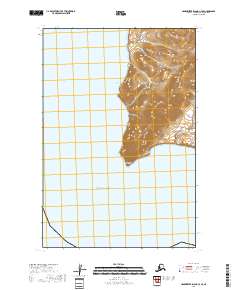
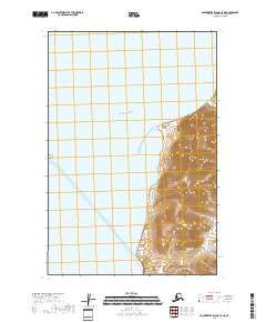
2018 Map of Hagemeister Island C-4 SE
USGS Topo · Published 2018About this map
Pacific Ocean waters dominate the western and southern expanses of this coastal Alaskan landscape, where the tides meet a prominent peninsula of the Bristol Bay region. The terrain is defined by the sharp topographical rise of Calm Point, a coastal feature that stands as a transition between the open sea and the inland heights. This 2018 survey reveals a landscape largely shaped by natural forces, devoid of roads or settlements, where the Public Land Survey System grids—such as t18s r71w and t19s r71w—overlay a shoreline that has long served as a landmark for navigation and subsistence in the Dillingham Census Area.
Find a feature on this map
6 named features on this map. Tap any name to fly to it.
Don’t see what you’re looking for? This feature index may not catch every label — zoom into the map to look around manually.
Map Details
Editions of this 2018 Hagemeister Island C-4 SE Map
This is the sole edition of this map. No revisions or reprints were ever made.
Other maps of this area

1948 · Hagemeister Island C-4
USGS Topo · 1:63,360

1948 · Hagemeister Island C-3
USGS Topo · 1:63,360

1951 · Hagemeister Island
USGS Topo · 1:250,000

1952 · Hagemeister Island C-3
USGS Topo · 1:63,360

1952 · Hagemeister Island C-4
USGS Topo · 1:63,360

1957 · Hagemeister Island
USGS Topo · 1:250,000
2018 · Hagemeister Island C-4 NW
USGS Topo · 1:25,000
2018 · Hagemeister Island C-3 NW
USGS Topo · 1:25,000
2018 · Hagemeister Island C-3 SW
USGS Topo · 1:25,000
2018 · Hagemeister Island C-4 NE
USGS Topo · 1:25,000