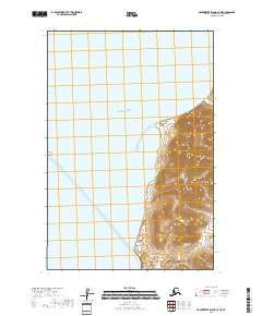
2018 Map of Hagemeister Island C-4 NE
USGS Topo · Published 2018About this map
Hagemeister Island dominates the eastern landscape of this coastal survey, where steep terrain rises sharply from the shorelines of the Pacific Ocean. This particular section of the island is characterized by dense contour lines indicating significant elevation gains near the coast, contrasting with the open water of the Hagemeister Strait to the west. The map provides a clear look at the uninhabited and natural state of this remote Alaskan landmass within the Dillingham Census Area. The absence of roads or structures emphasizes the wilderness character of the region, where the land meets the sea at the far reaches of the Bristol Bay area. Boundary markers for several townships, including t17s r71w and t18s r71w, provide a framework for the island's geography.
Find a feature on this map
9 named features on this map. Tap any name to fly to it.
Don’t see what you’re looking for? This feature index may not catch every label — zoom into the map to look around manually.
Map Details
Editions of this 2018 Hagemeister Island C-4 NE Map
This is the sole edition of this map. No revisions or reprints were ever made.
Other maps of this area

1948 · Hagemeister Island D-3
USGS Topo · 1:63,360

1948 · Hagemeister Island C-4
USGS Topo · 1:63,360

1948 · Hagemeister Island C-3
USGS Topo · 1:63,360

1951 · Hagemeister Island
USGS Topo · 1:250,000

1952 · Hagemeister Island C-3
USGS Topo · 1:63,360

1952 · Hagemeister Island C-4
USGS Topo · 1:63,360

1954 · Hagemeister Island D-4
USGS Topo · 1:63,360

1957 · Hagemeister Island
USGS Topo · 1:250,000
2018 · Hagemeister Island C-4 NW
USGS Topo · 1:25,000
2018 · Hagemeister Island C-4 SE
USGS Topo · 1:25,000