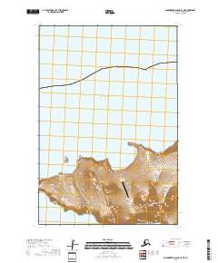
2018 Map of Hagemeister Island C-7 NE
USGS Topo · Published 2018About this map
The Cape Newenham Long Range Radar Site occupies a prominent position on this coastal Alaskan peninsula, reflecting the area's strategic importance for air defense and communication. Situated where the Kuskokwim Bay meets the Pacific Ocean, the landscape is defined by its dramatic maritime interface. Further inland, the terrain ascends sharply toward the peaks of Jagged Mtn, while the isolated Bird Rock sits just off the western shoreline. This 2018 survey captures a sparsely populated but technologically significant corner of the Bethel Census Area, where military infrastructure coexists with the raw topographical features of the Aleutian Range's northern reaches.
Find a feature on this map
11 named features on this map. Tap any name to fly to it.
Don’t see what you’re looking for? This feature index may not catch every label — zoom into the map to look around manually.
Map Details
Editions of this 2018 Hagemeister Island C-7 NE Map
This is the sole edition of this map. No revisions or reprints were ever made.
Other maps of this area
1947 · Hagemeister Island C-7
USGS Topo · 1:63,360

1948 · Hagemeister Island C-6
USGS Topo · 1:63,360

1950 · Hagemeister Island D-6
USGS Topo · 1:63,360

1951 · Hagemeister Island
USGS Topo · 1:250,000
1952 · Hagemeister Island C-7
USGS Topo · 1:63,360

1952 · Hagemeister Island C-6
USGS Topo · 1:63,360

1957 · Hagemeister Island
USGS Topo · 1:250,000
2018 · Hagemeister Island C-6 NW
USGS Topo · 1:25,000
2018 · Hagemeister Island D-6 SW
USGS Topo · 1:25,000
2018 · Hagemeister Island C-6 SW
USGS Topo · 1:25,000