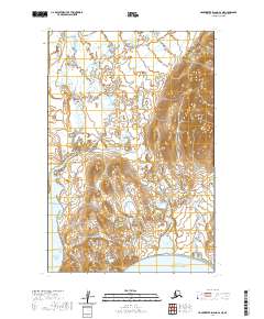
2020 Map of Hagemeister Island D-1 NE
USGS Topo · Published 2020About this map
Ungalikthluk sits along the winding course of the Ungalikthluk River in this coastal Alaskan landscape, where the land meets the northern reaches of the Pacific Ocean. This modern topographic study reveals a complex network of wetlands and tundra ponds characteristic of the Dillingham Census Area. To the east, the large basin of Nunavachak Lake drains toward the coast, terminating at the protected waters of Nunavachak Bay. The geography is defined by low-lying hydrologic features and the tidal influence of Ungalikthluk Bay, illustrating the remote wilderness where river systems and coastal inlets dictate the shape of the terrain and human presence.
Find a feature on this map
10 named features on this map. Tap any name to fly to it.
Don’t see what you’re looking for? This feature index may not catch every label — zoom into the map to look around manually.
Map Details
Editions of this 2020 Hagemeister Island D-1 NE Map
This is the sole edition of this map. No revisions or reprints were ever made.
Other maps of this area

1945 · Nushagak Bay
USGS Topo · 1:250,000

1949 · Nushagak Bay
USGS Topo · 1:250,000

1950 · Nushagak Bay D-6
USGS Topo · 1:63,360

1950 · Hagemeister Island D-1
USGS Topo · 1:63,360

1951 · Goodnews
USGS Topo · 1:250,000

1951 · Hagemeister Island
USGS Topo · 1:250,000

1951 · Nushagak Bay
USGS Topo · 1:250,000

1952 · Hagemeister Island D-1
USGS Topo · 1:63,360

1954 · Goodnews A-4
USGS Topo · 1:63,360

1954 · Goodnews A-3
USGS Topo · 1:63,360