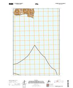
2020 Map of Hagemeister Island D-1 SE
USGS Topo · Published 2020About this map
Nunavachak Bay and the northern reaches of Pacific Ocean define this coastal corner of Southwest Alaska. This 2020 survey documents a largely maritime environment where the waters of Bristol Bay meet a high, ridge-lined coast. The northern portion of the map shows significant elevation, with topographic contours rising sharply from the shoreline to inland peaks. These landforms are segmented by the Public Land Survey System, specifically within Townships 15 South, Range 65 West and 15 South, Range 64 West. The map provides a precise look at the interface between the open ocean and the sheltered inlet of Nunavachak Bay, capturing the drainage patterns and coastal topography of the Dillingham Census Area.
Find a feature on this map
7 named features on this map. Tap any name to fly to it.
Don’t see what you’re looking for? This feature index may not catch every label — zoom into the map to look around manually.
Map Details
Editions of this 2020 Hagemeister Island D-1 SE Map
This is the sole edition of this map. No revisions or reprints were ever made.
Other maps of this area

1945 · Nushagak Bay
USGS Topo · 1:250,000

1948 · Hagemeister Island C-1
USGS Topo · 1:63,360

1949 · Nushagak Bay
USGS Topo · 1:250,000

1950 · Nushagak Bay D-6
USGS Topo · 1:63,360

1950 · Hagemeister Island D-1
USGS Topo · 1:63,360

1951 · Hagemeister Island
USGS Topo · 1:250,000

1951 · Nushagak Bay
USGS Topo · 1:250,000

1952 · Hagemeister Island C-1
USGS Topo · 1:63,360

1952 · Hagemeister Island D-1
USGS Topo · 1:63,360

1957 · Hagemeister Island
USGS Topo · 1:250,000