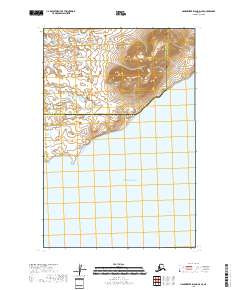
2018 Map of Hagemeister Island D-4 SE
USGS Topo · Published 2018About this map
The Pacific Ocean dominates this maritime landscape along the boundary of the Bethel Census Area and the Dillingham Census Area. In this sparsely settled coastal region, the shoreline is defined by the sheltered waters of the Hagemeister Strait, which separates the mainland from the island for which the quadrangle is named. The terrain transitions sharply from the open sea into a series of steep coastal ridges, with elevations rising quickly from the tidewater to over 1,200 feet.
Find a feature on this map
7 named features on this map. Tap any name to fly to it.
Don’t see what you’re looking for? This feature index may not catch every label — zoom into the map to look around manually.
Map Details
Editions of this 2018 Hagemeister Island D-4 SE Map
This is the sole edition of this map. No revisions or reprints were ever made.
Other maps of this area

1948 · Hagemeister Island D-3
USGS Topo · 1:63,360

1948 · Hagemeister Island C-4
USGS Topo · 1:63,360

1948 · Hagemeister Island C-3
USGS Topo · 1:63,360

1951 · Hagemeister Island
USGS Topo · 1:250,000

1952 · Hagemeister Island C-3
USGS Topo · 1:63,360

1952 · Hagemeister Island C-4
USGS Topo · 1:63,360

1954 · Hagemeister Island D-4
USGS Topo · 1:63,360

1957 · Hagemeister Island
USGS Topo · 1:250,000
2018 · Hagemeister Island C-4 NW
USGS Topo · 1:25,000
2018 · Hagemeister Island D-3 NW
USGS Topo · 1:25,000