
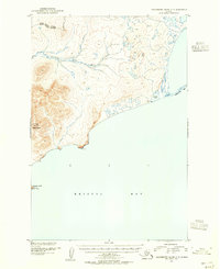
1950 Map of Hagemeister Island D-5
USGS Topo · Published 1982About this map
Industrial mining activity and wildlife conservation intersect on this Alaskan coast, where the Goodnews Mining Camp and the settlement of Platinum sit at the base of Red Mountain. The landscape is heavily marked by extractive operations, with prominent Tailings and a Ditch system tracing the flow of Platinum Creek and Fox Gulch near the local Landing Strip. These features highlight the mid-century significance of the region's mineral deposits, particularly platinum, which gave the local town its name.
Find a feature on this map
37 named features on this map. Tap any name to fly to it.
Don’t see what you’re looking for? This feature index may not catch every label — zoom into the map to look around manually.
Map Details
Editions of this 1950 Hagemeister Island D-5 Map
This is the sole edition of this map. No revisions or reprints were ever made.
Other maps of this area

1948 · Hagemeister Island C-6
USGS Topo · 1:63,360

1948 · Hagemeister Island C-4
USGS Topo · 1:63,360

1948 · Hagemeister Island C-5
USGS Topo · 1:63,360

1950 · Hagemeister Island D-6
USGS Topo · 1:63,360

1951 · Goodnews
USGS Topo · 1:250,000

1951 · Hagemeister Island
USGS Topo · 1:250,000

1952 · Hagemeister Island C-6
USGS Topo · 1:63,360
1952 · Hagemeister Island C-5
USGS Topo · 1:63,360

1952 · Hagemeister Island C-4
USGS Topo · 1:63,360

1954 · Goodnews A-8
USGS Topo · 1:63,360